JourneyOn
JourneyOn is an area within Brighton & Hove City Council’s website with information about public transport within the city, including live bus and train times.
Background
Brighton & Hove City Council are embracing open source across their organisation, and now use Drupal as a platform for many of their sites.
The council recently rebuilt and styled their main website in Drupal. Following this it made sense to incorporate the JourneyOn microsite into the main site, to increase visibility, take advantage of the responsive layout and have a consistent look and feel.
In February 2015, JourneyOn was shortlisted for the best smarter travel app in the Landor Links smarter travel awards.
Live bus times
A study by Brighton-based usability consultancy Clearleft highlighted a problem with many travel information websites and apps - they often don’t answer the question of which bus stop do I need?
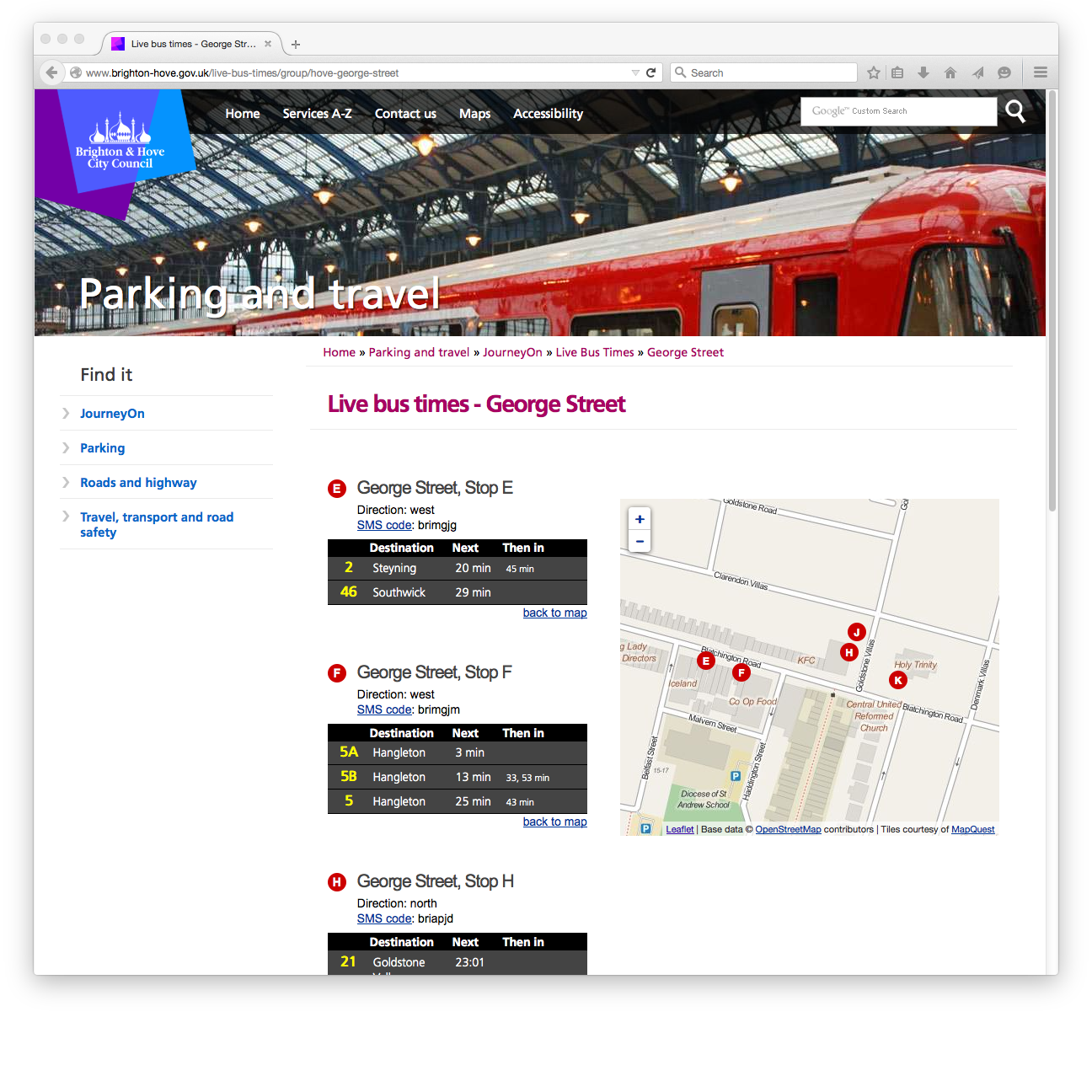
To address this, we have introduced the concept of a group of bus stops into the site. Typically these have the same name and are close enough geographically to be considered a single entity.
Each group now has its own page on the site, with a meaningful URL and breadcrumbs. Pages contain a map of the surrounding area, and departure boards for each actual stop. They are designed as a single point of information for buses at that location.
Departure boards are grouped by route to aid usability. Firstly, it conserves space and makes it easier to scan the page. Secondly, it makes it possible to show the next few departures for each route, giving a quick indicator of frequency.
Navigation
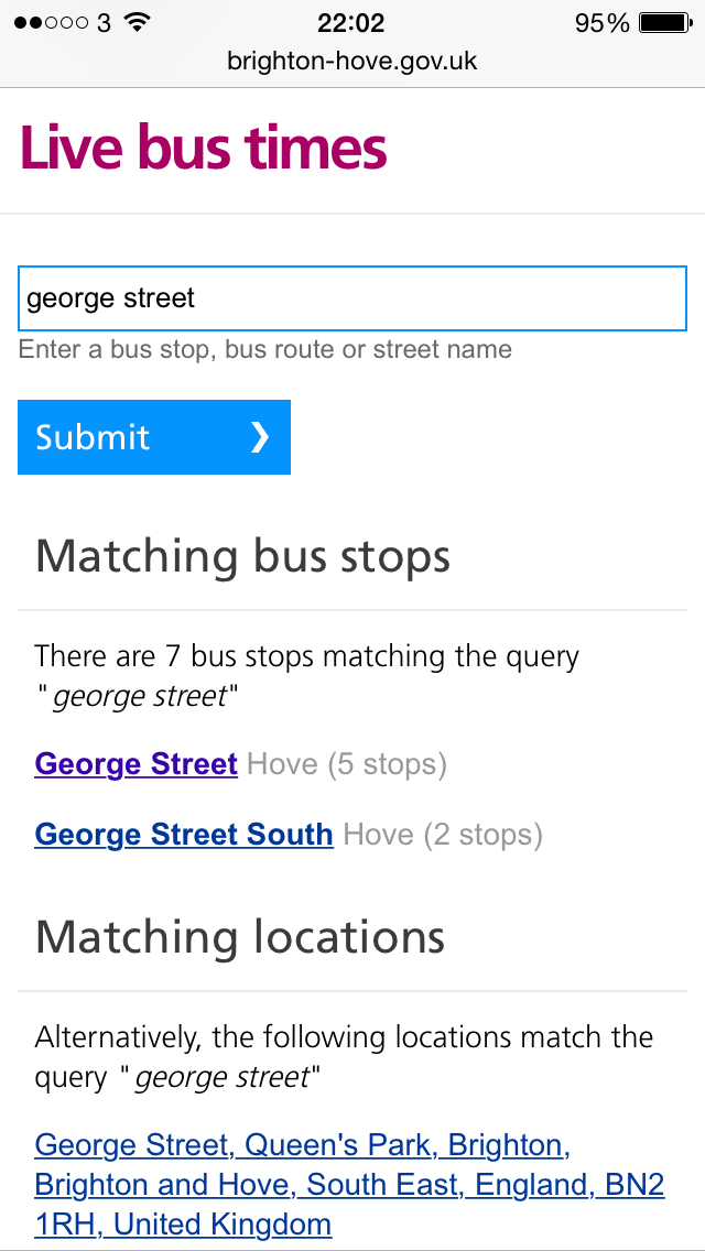
We’ve also streamlined the navigation. Complex forms with different fields for route, bus stop name, direction, etc. are difficult to use, particularly on a handheld device.
The bus stop navigation now consists of a single text entry field. The user is welcome to type in whatever they like, such as 5B
, Churchill Square
, or Pier
.
Their query is interpreted as either a route, exact stop or nearby place depending on what was entered. From there we provide suggestions to direct the user to the appropriate information.
Mapping
The project makes extensive use of OpenStreetMap data, both for displaying maps and as a source of place names.
Leaflet is an open source library for interactive maps. It is heavily customisable, allowing for nice usability enhancements such as the directional arrows on the bus stop markers.
Nominatim is a search API for place names within OpenStreetMap data. By contributing local knowledge of place names to OpenStreetMap, the dataset, and therefore search results improve over time, leading to a better user experience for this and other OSM-based products.
Route planner
JourneyOn includes a bespoke route planner. This was a separate project built by London-based transport consultancy Steer Davies Gleave. Part of my role involved a consultation on how to integrate this with the Drupal site.